Nevada Congressional District Wall Map
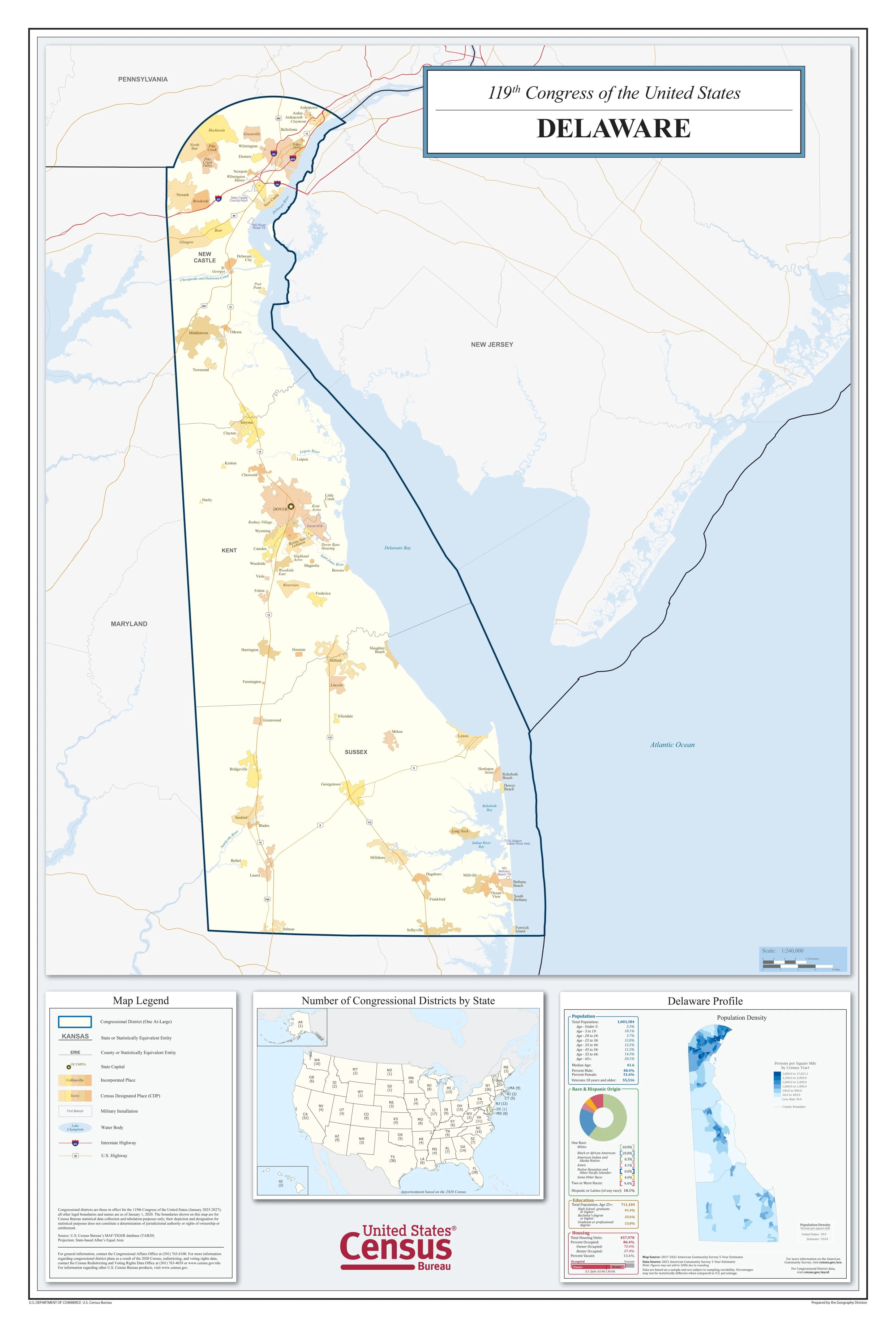
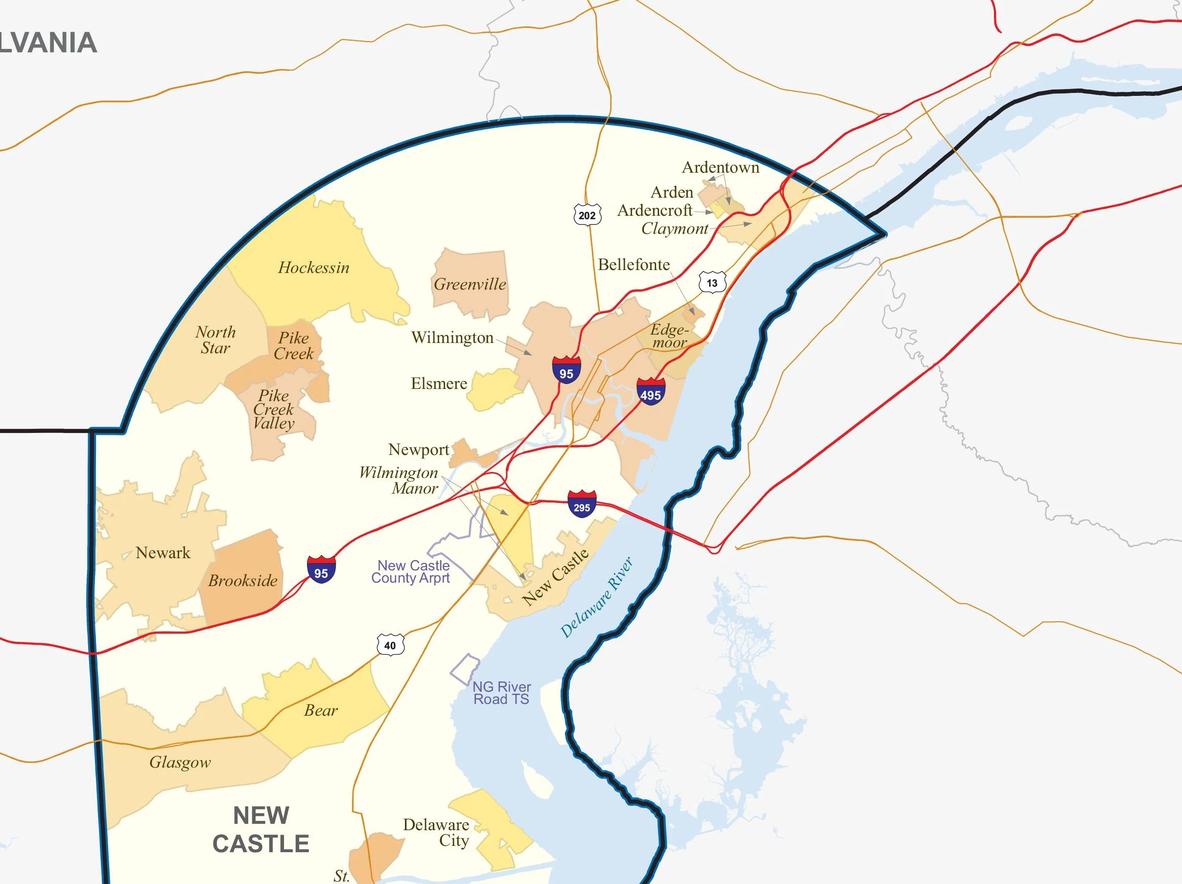
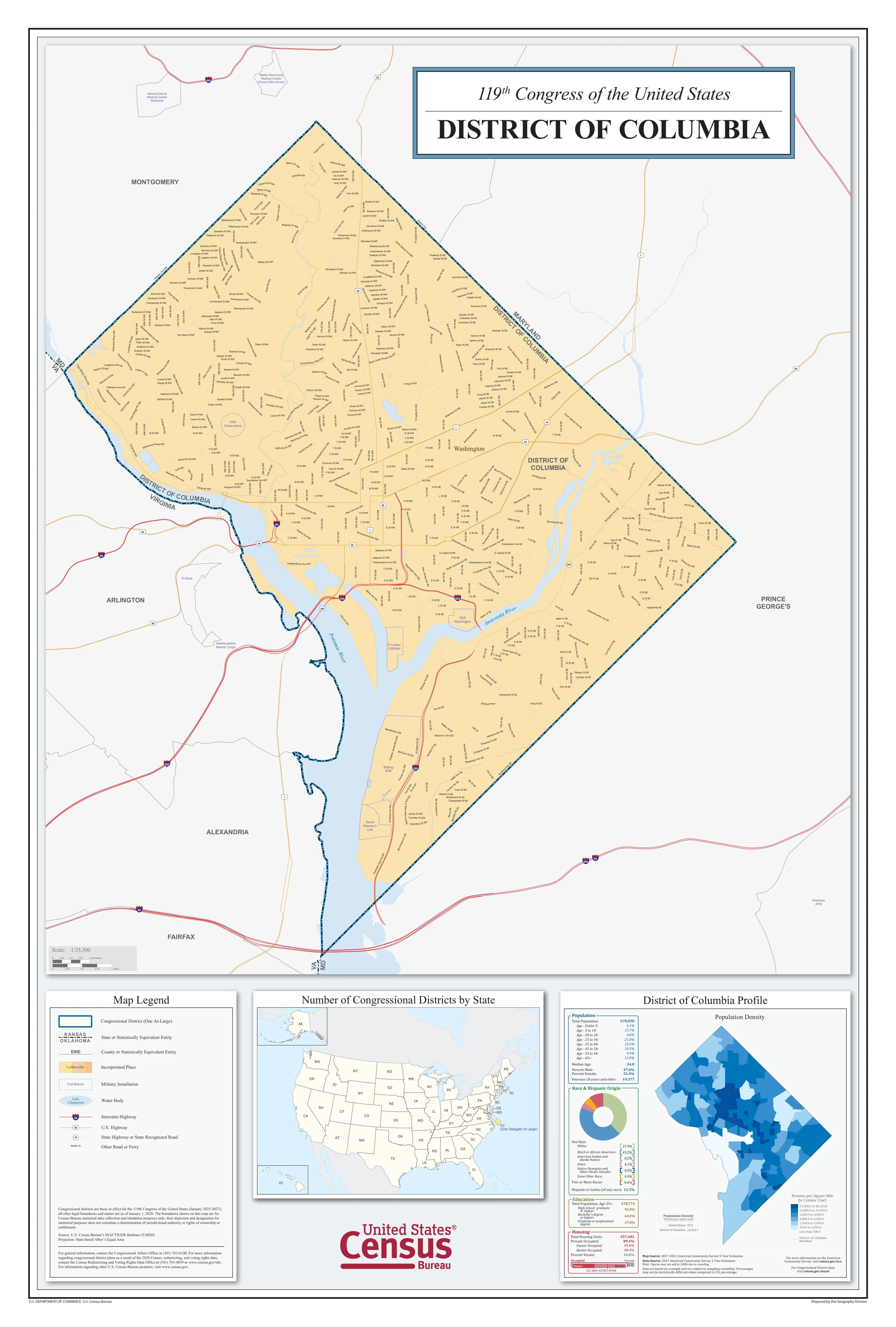
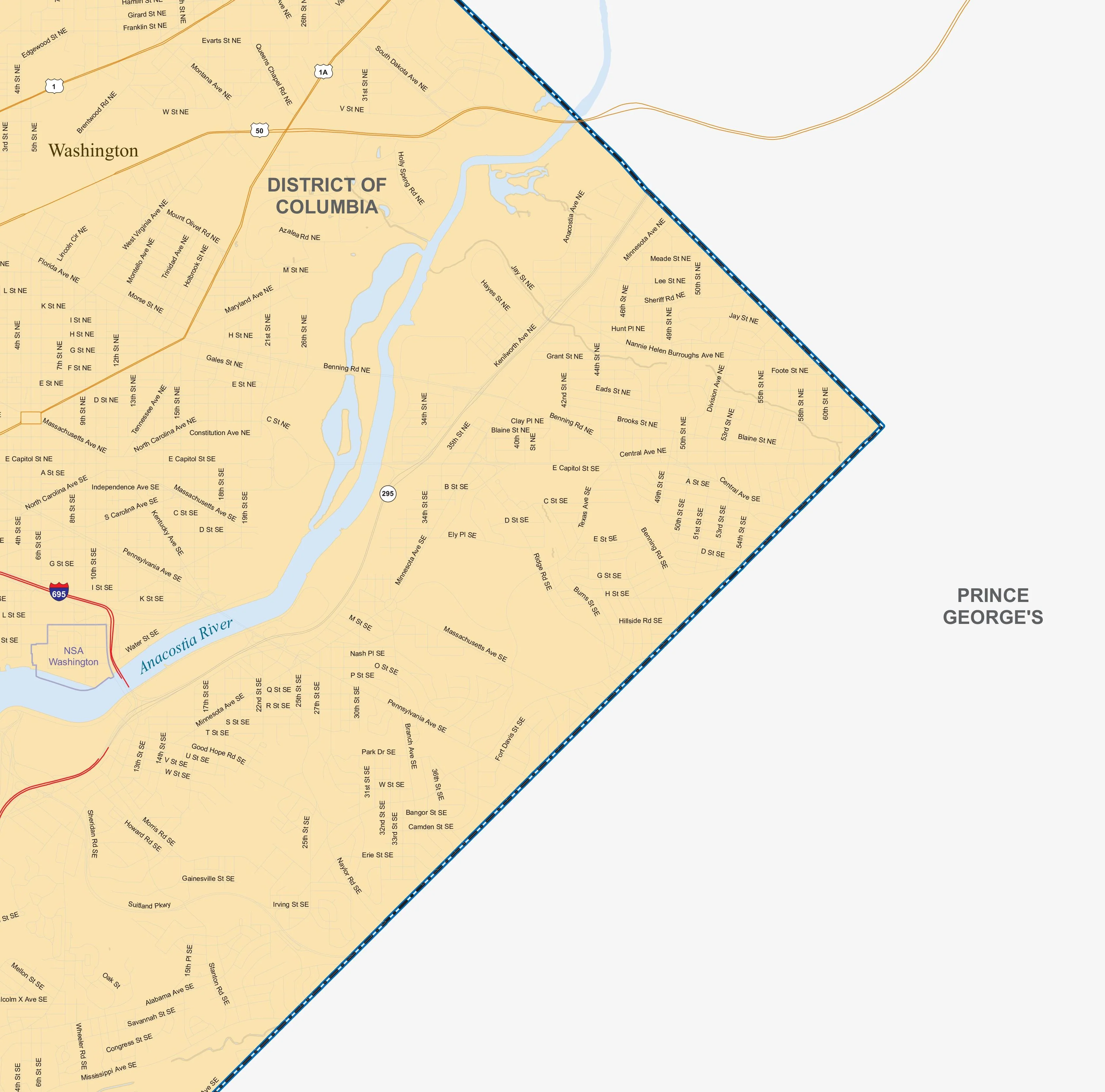
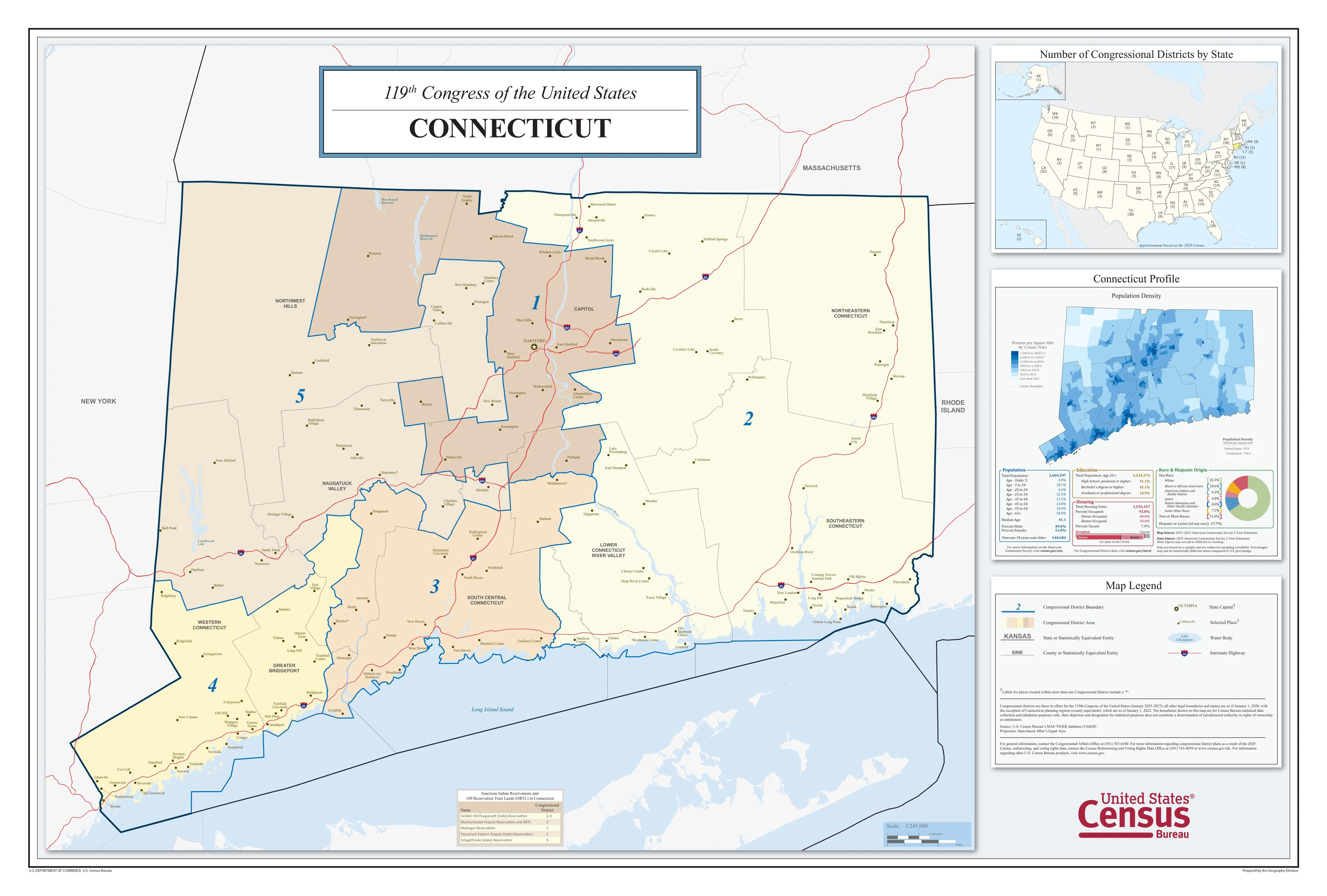
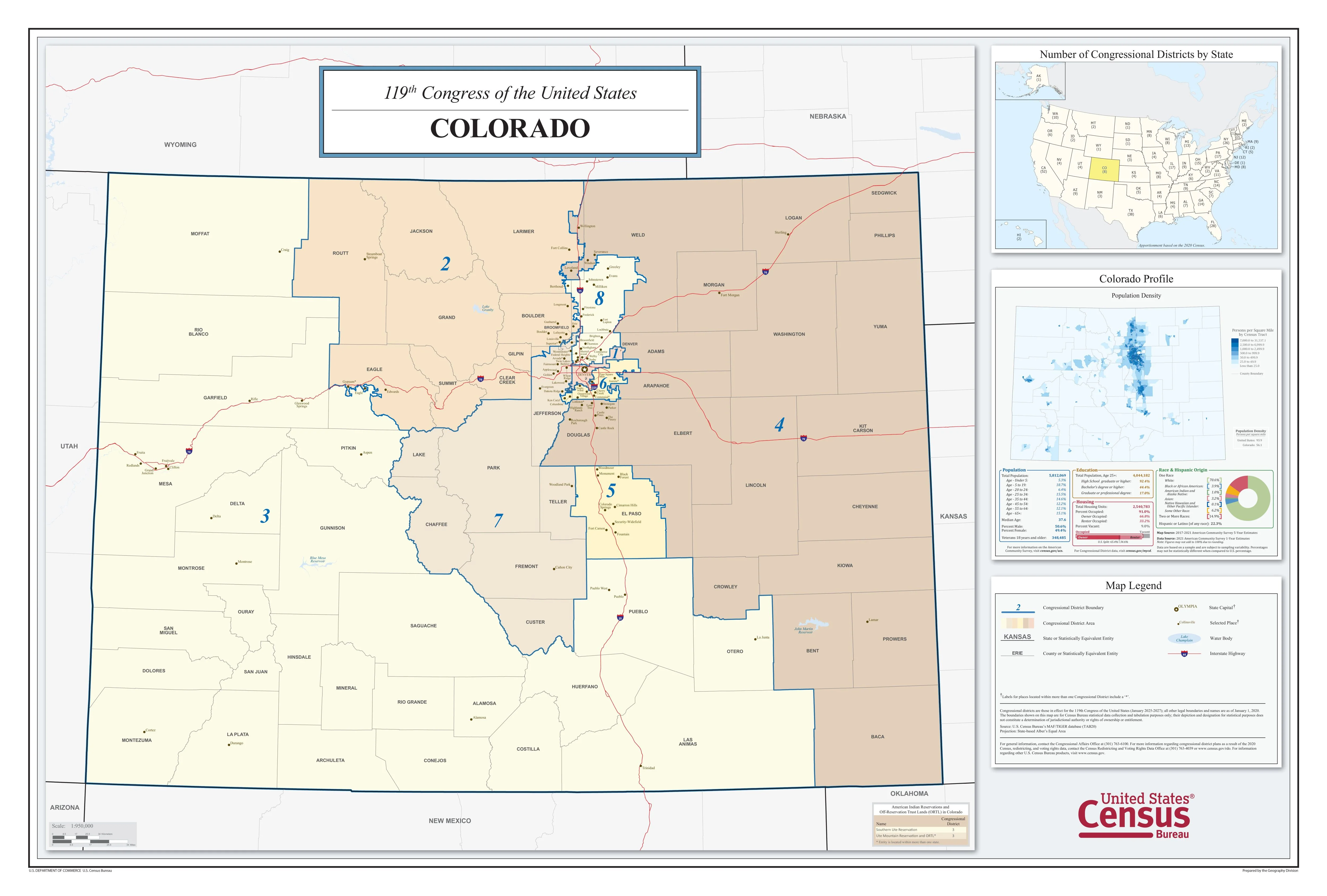
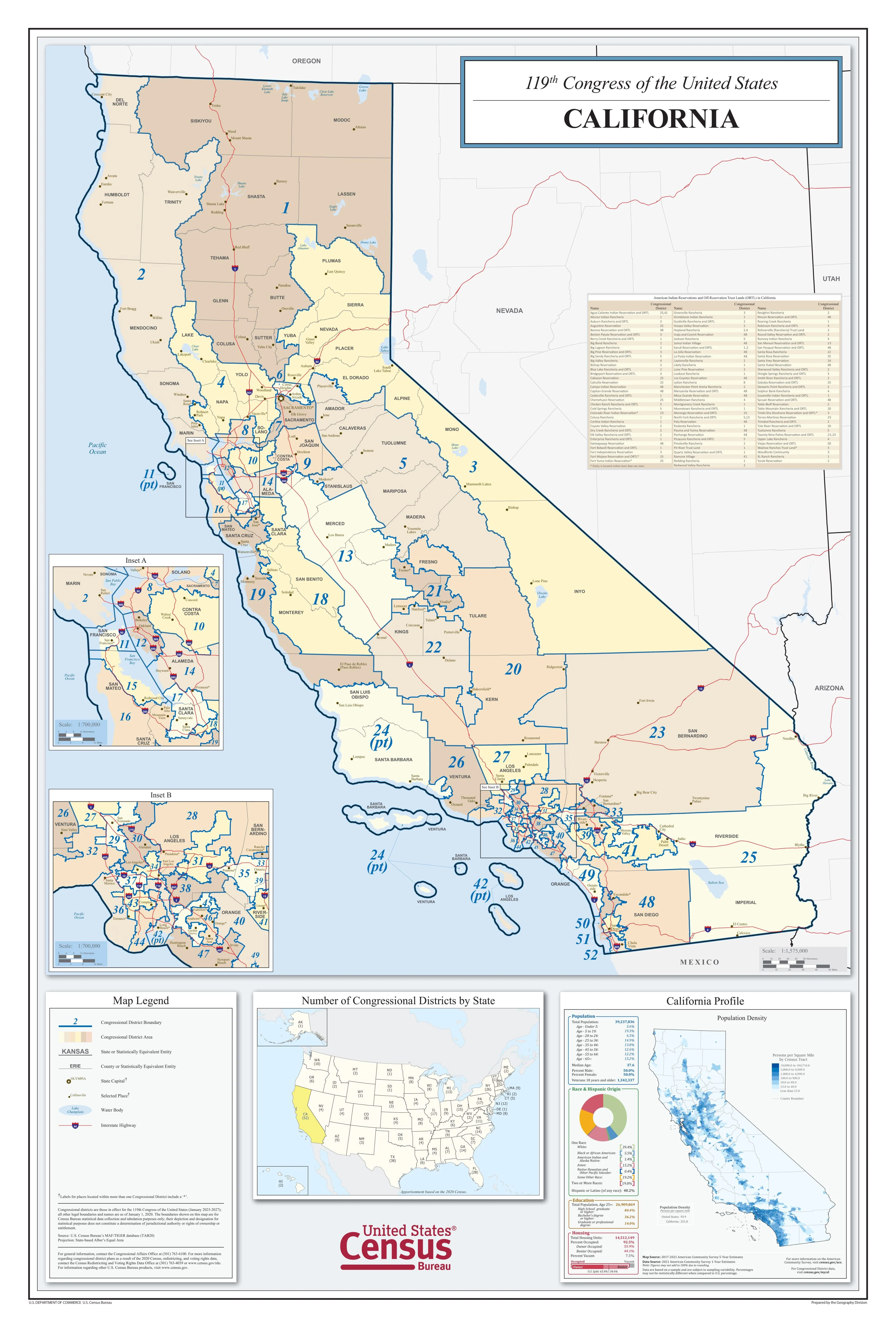
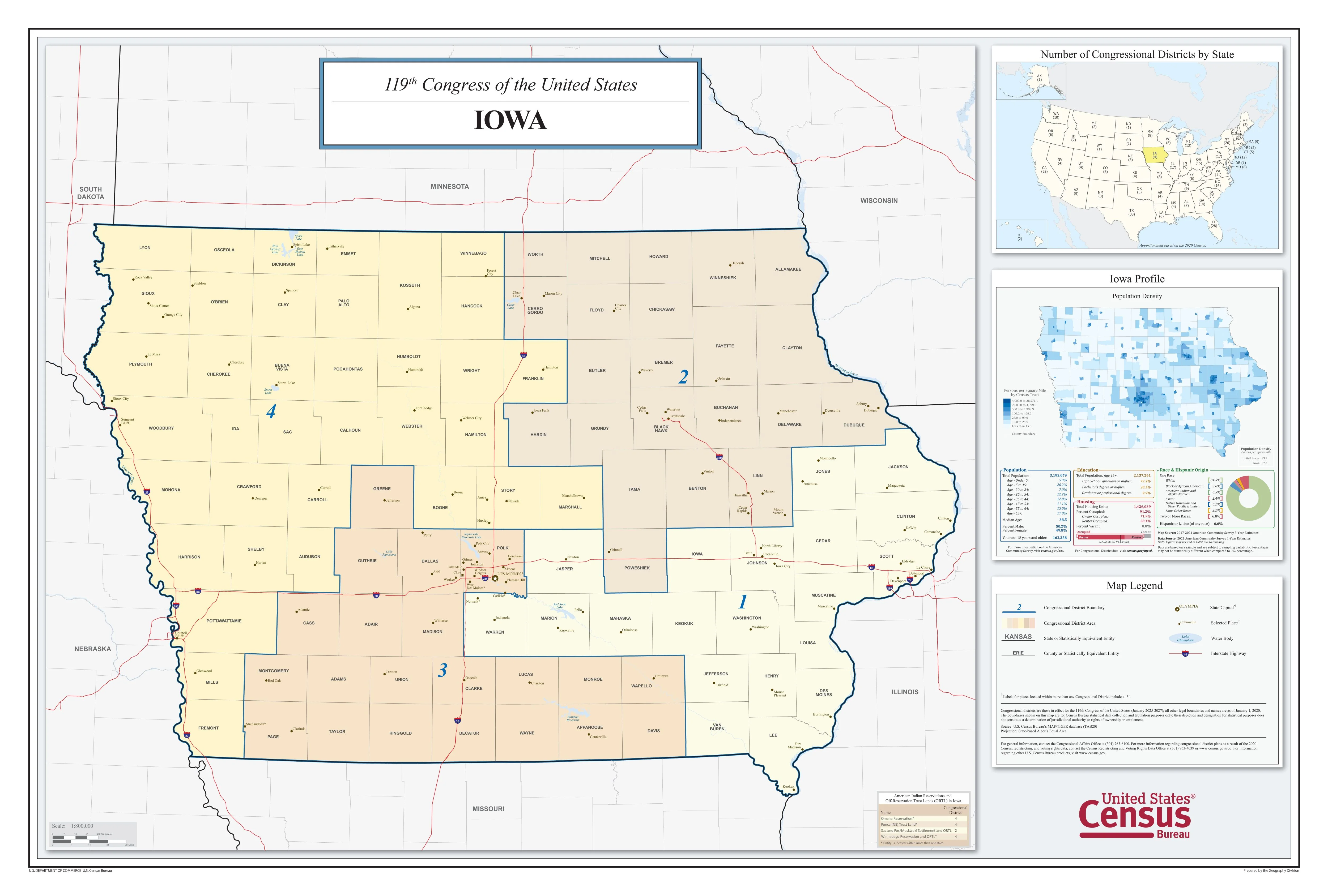
Nevada Congressional District Map
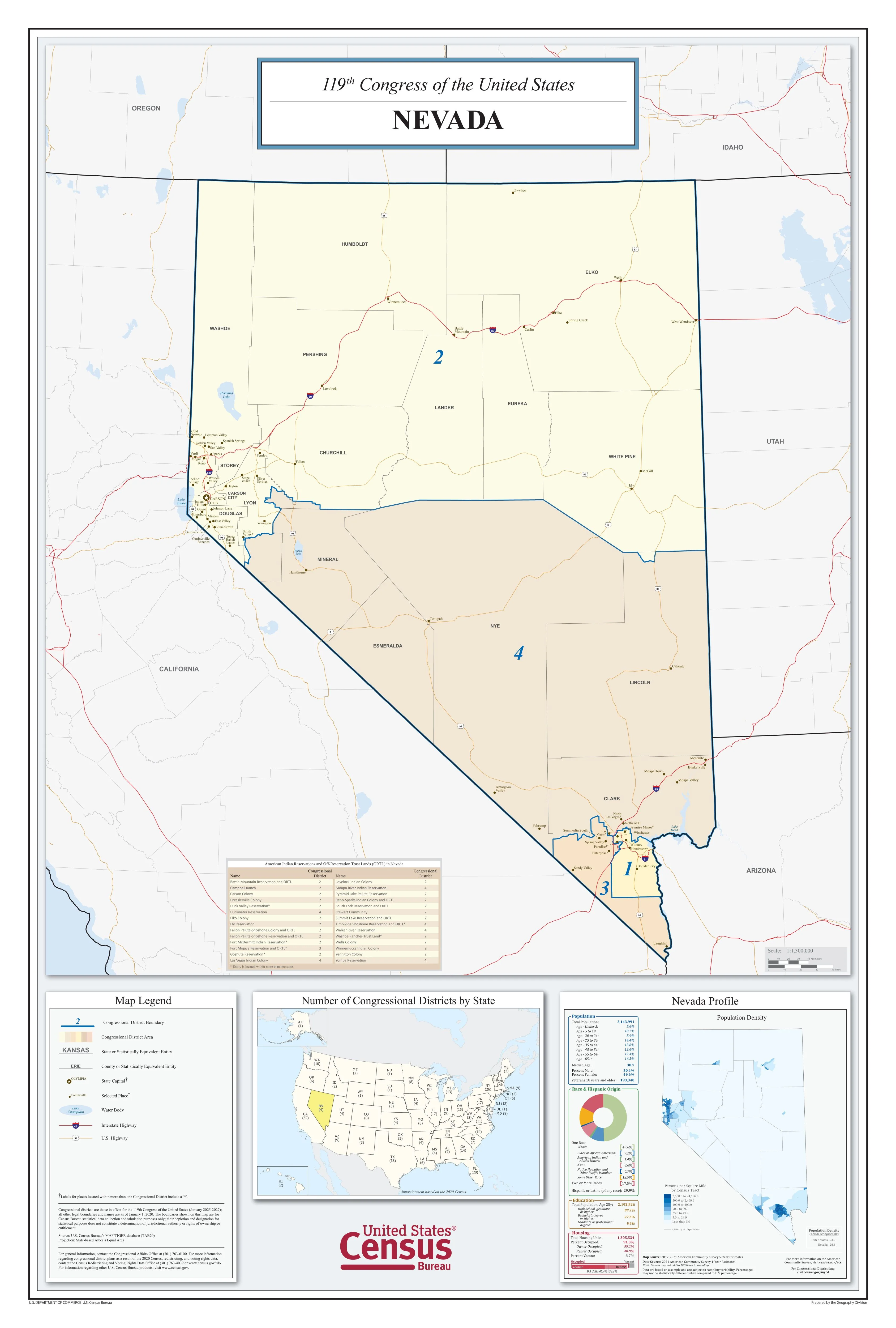
Understand Nebraska's political landscape with this updated congressional district map, designed for clarity and accuracy. Ideal for educational settings, professional offices, or anyone interested in civic engagement.
Highlights:
-
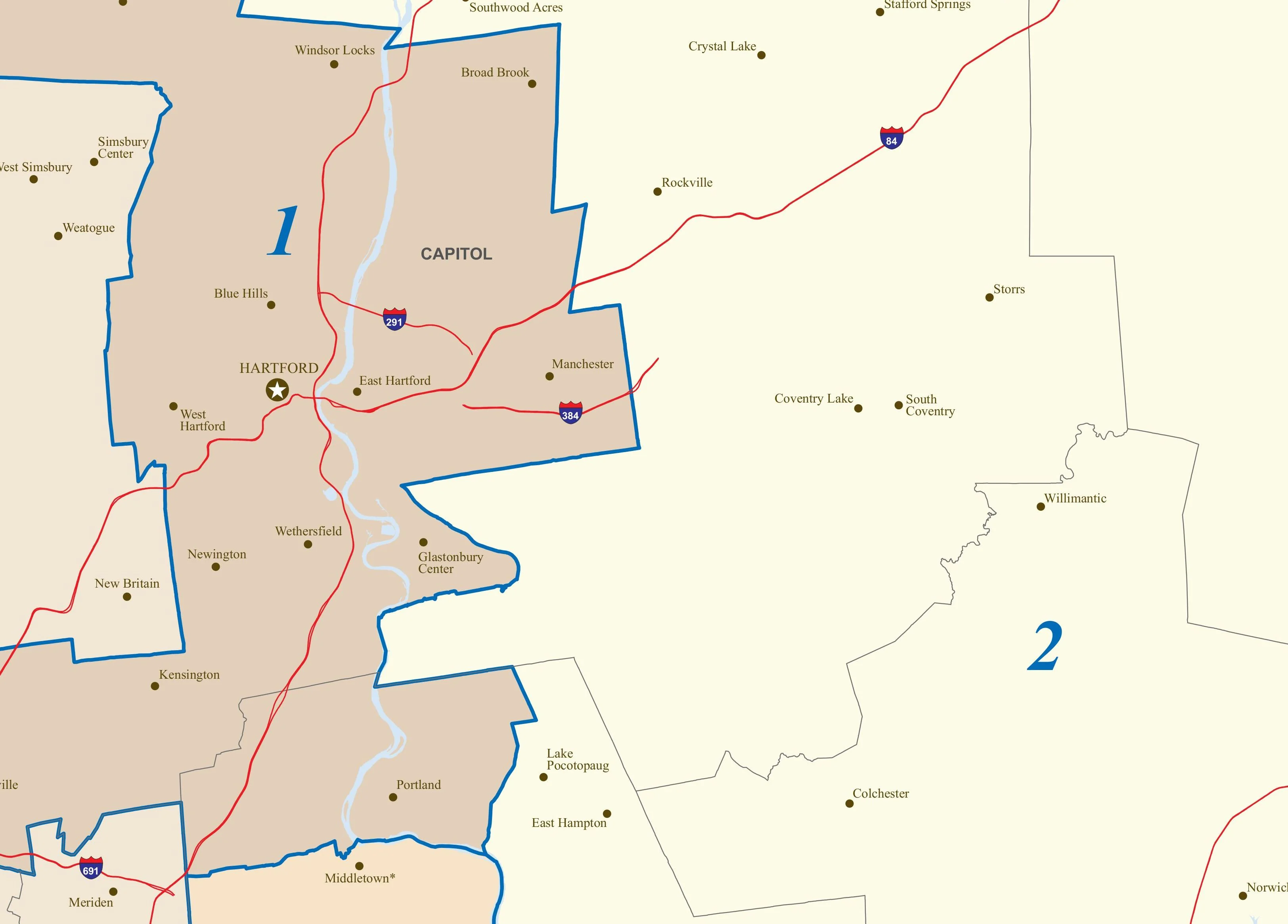
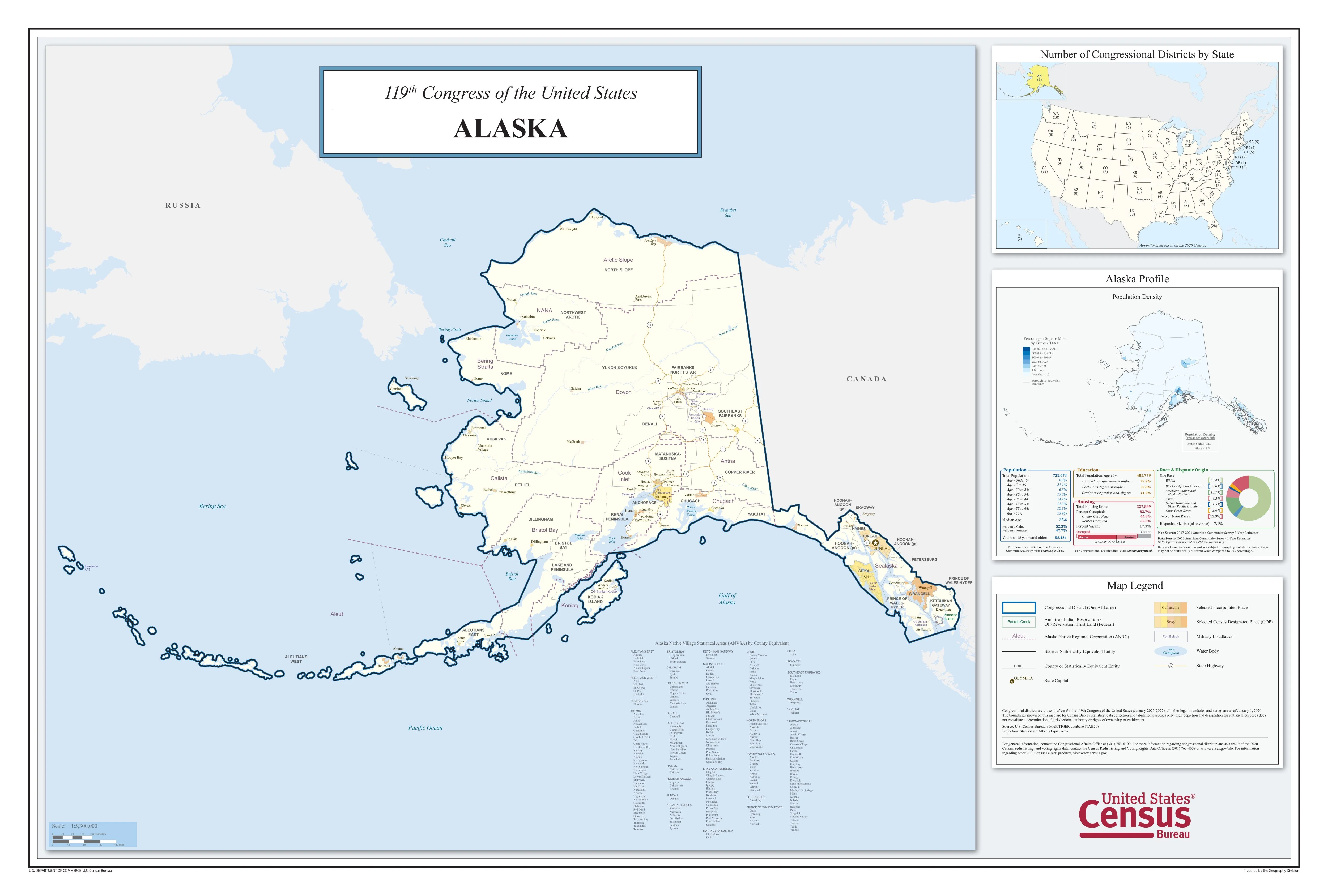
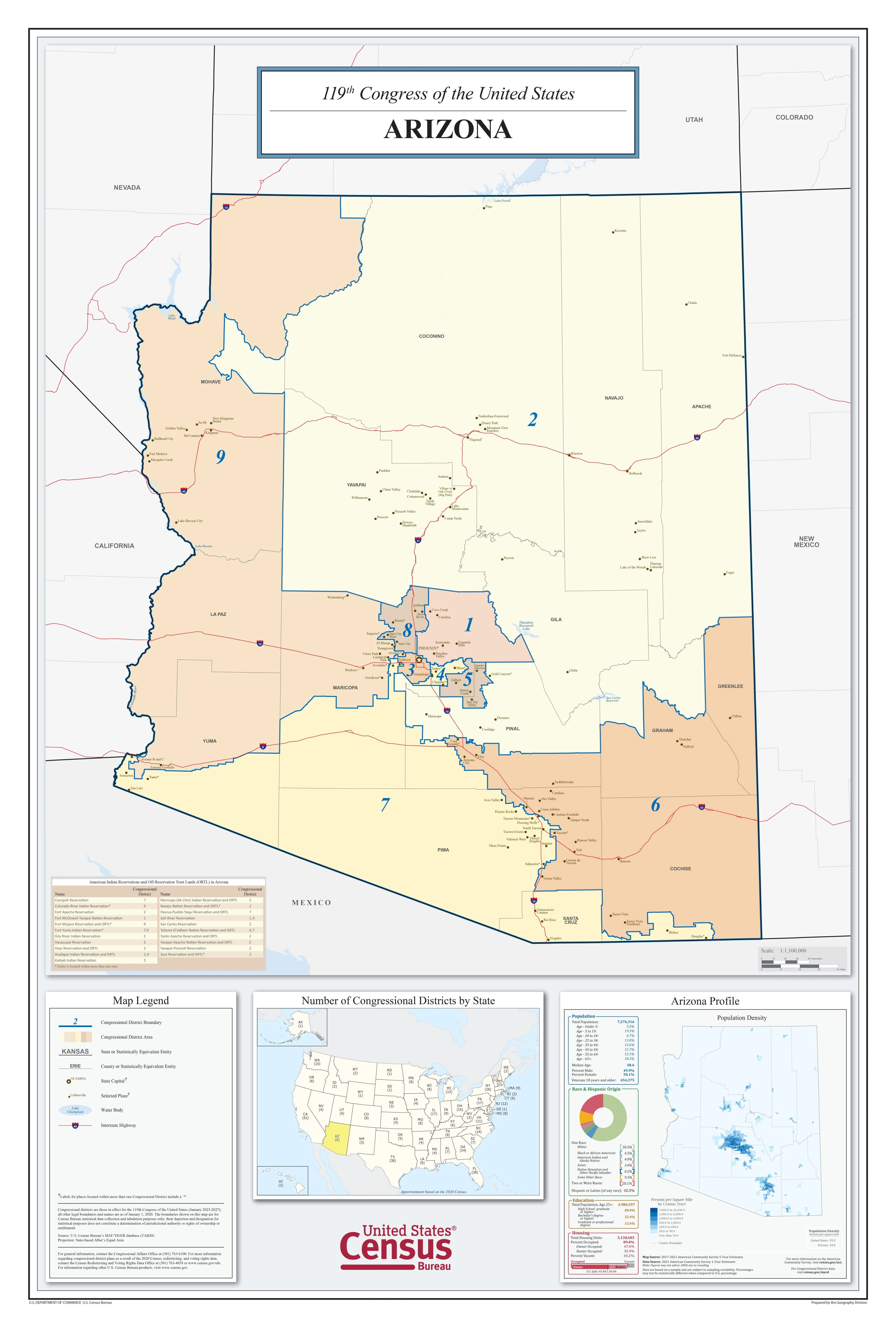
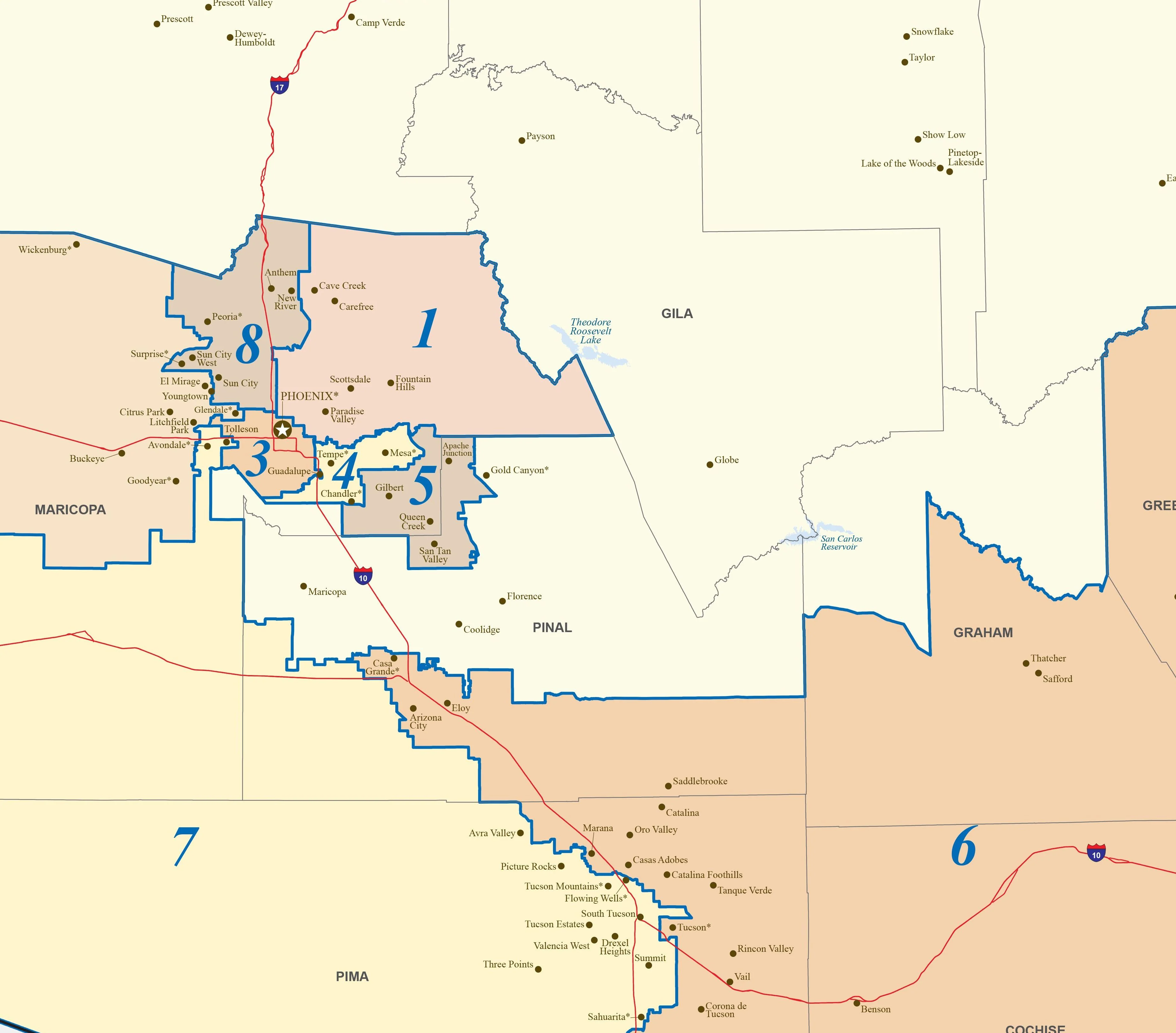
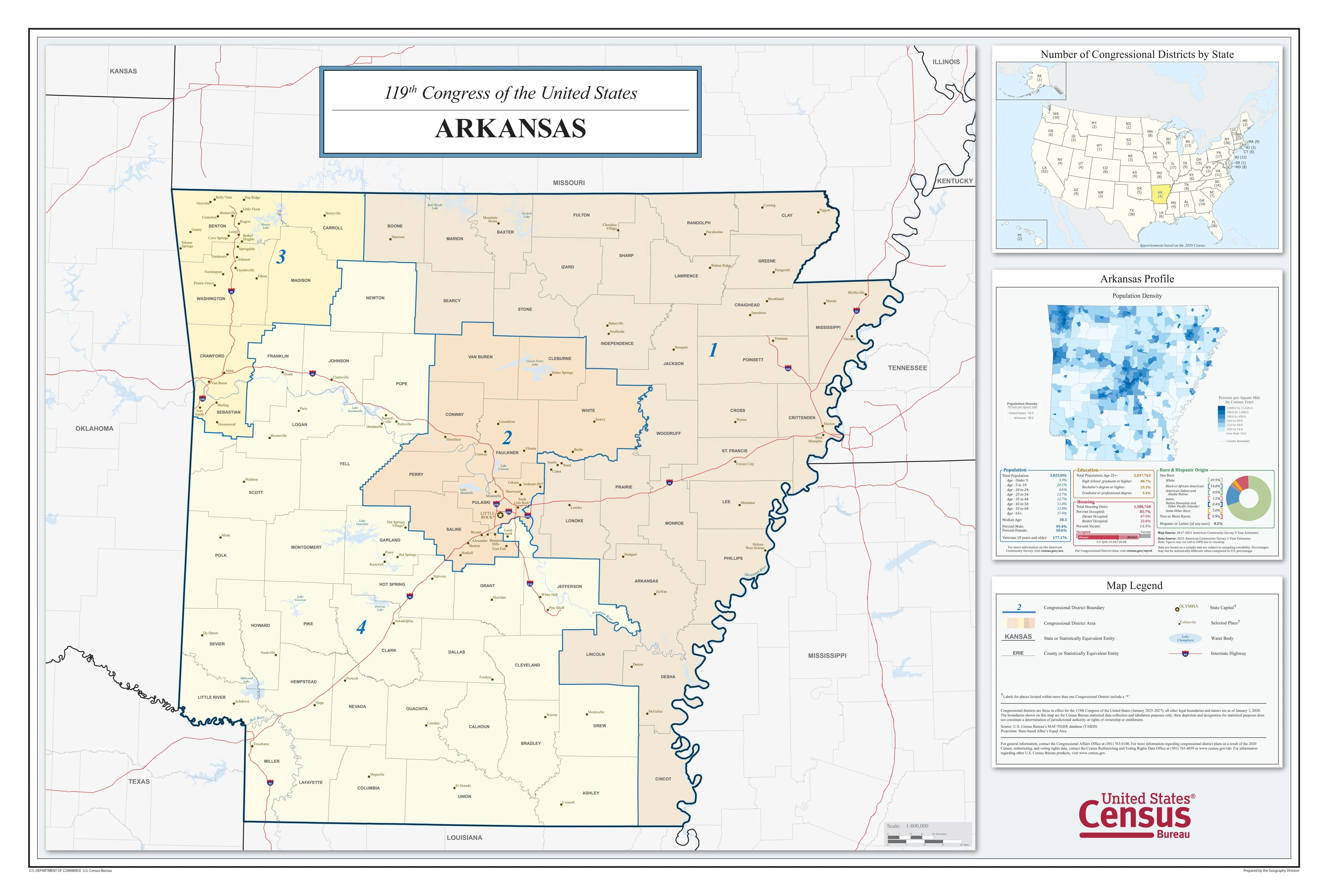
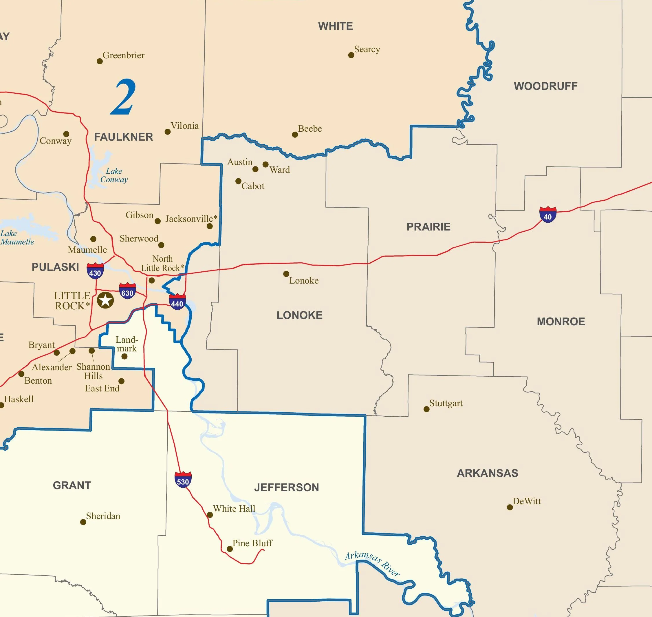
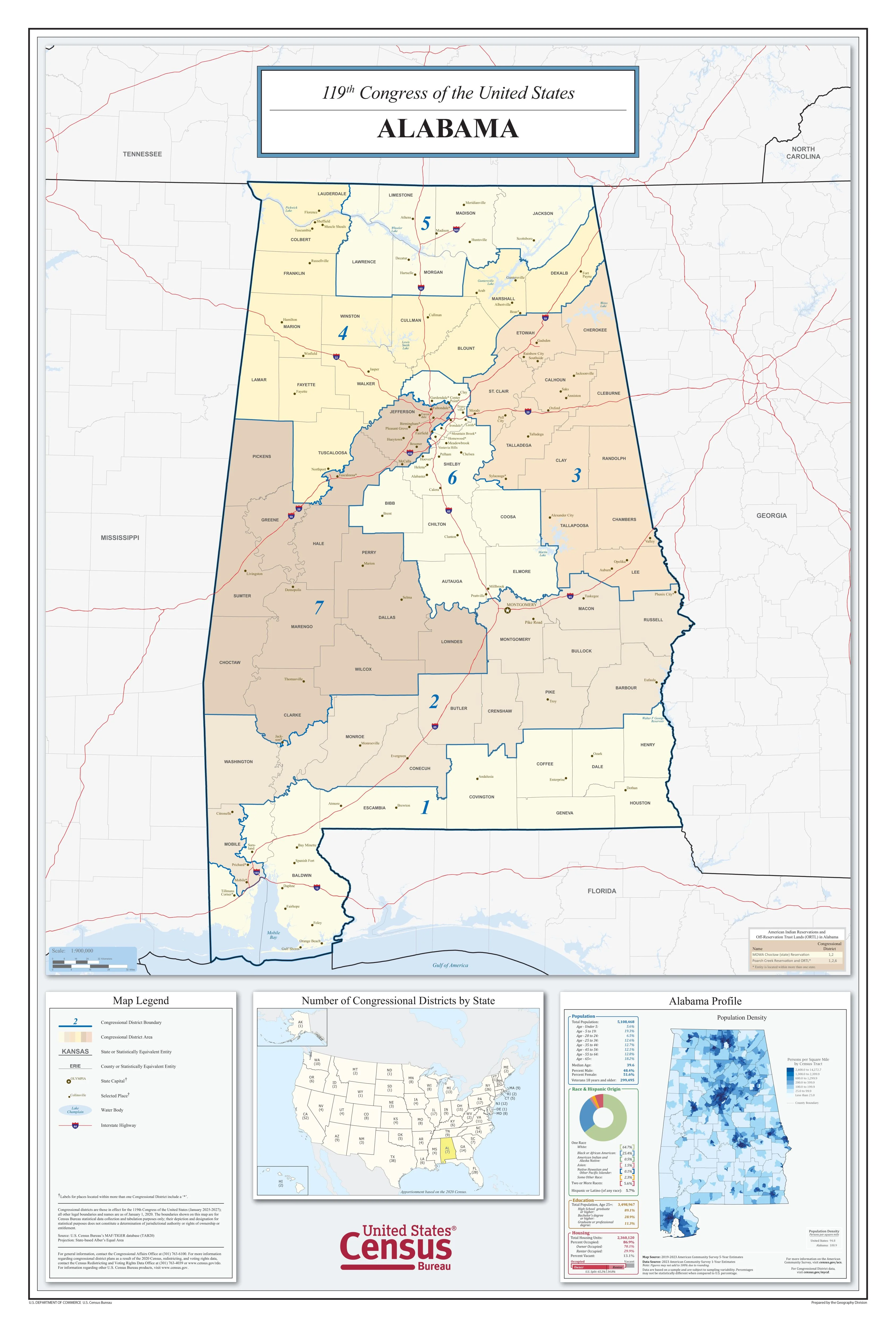
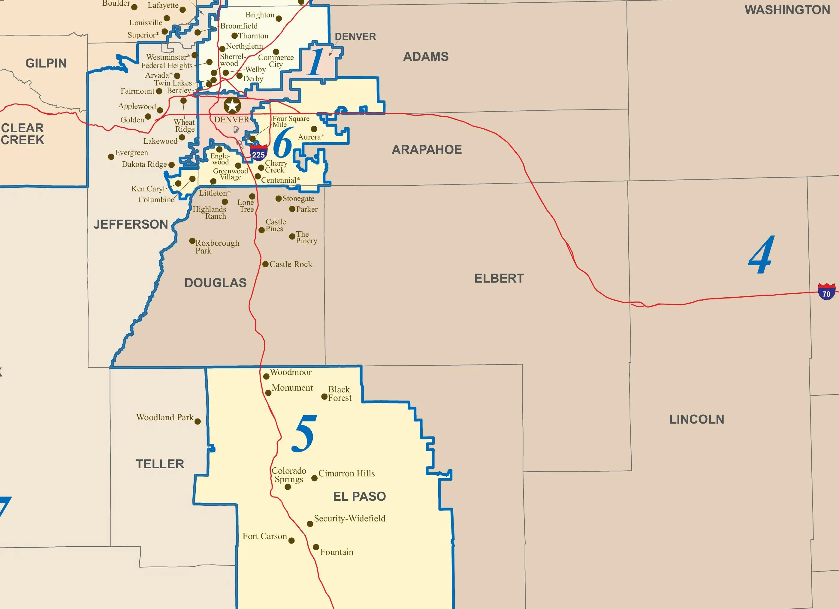
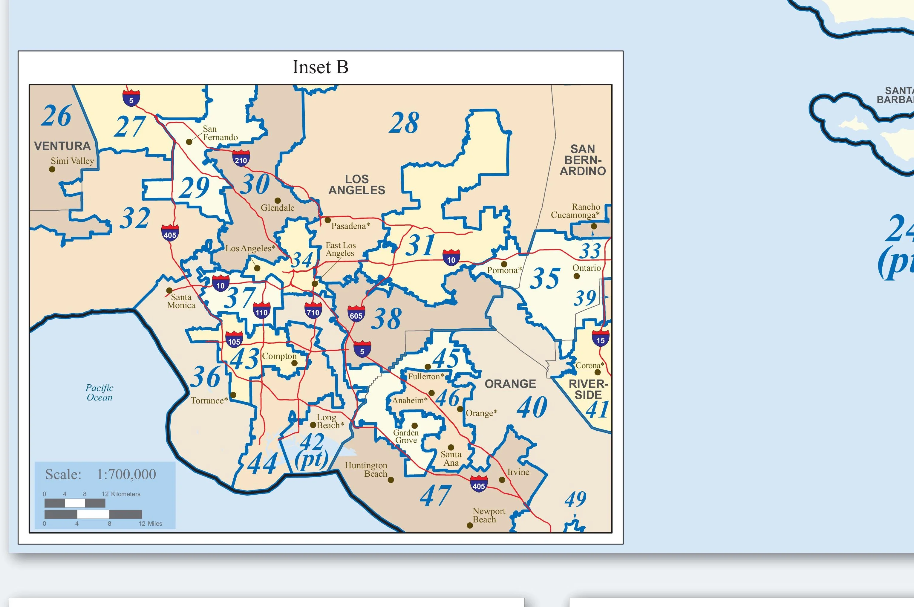
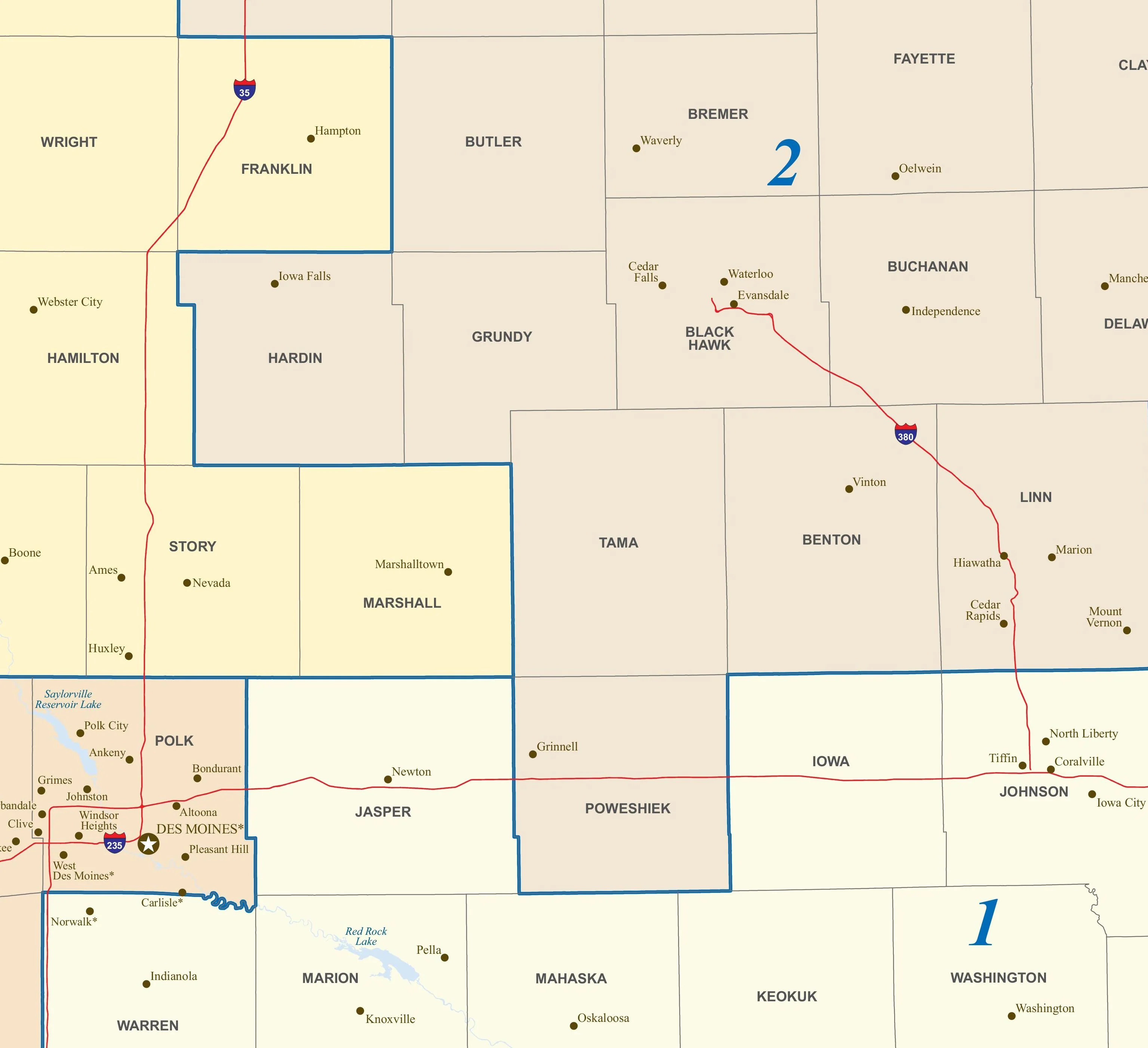
Shows all the congressional districts in Nevada with clear, color-coded boundaries
-
Includes counties, major highways, cities, and key geographic features
-
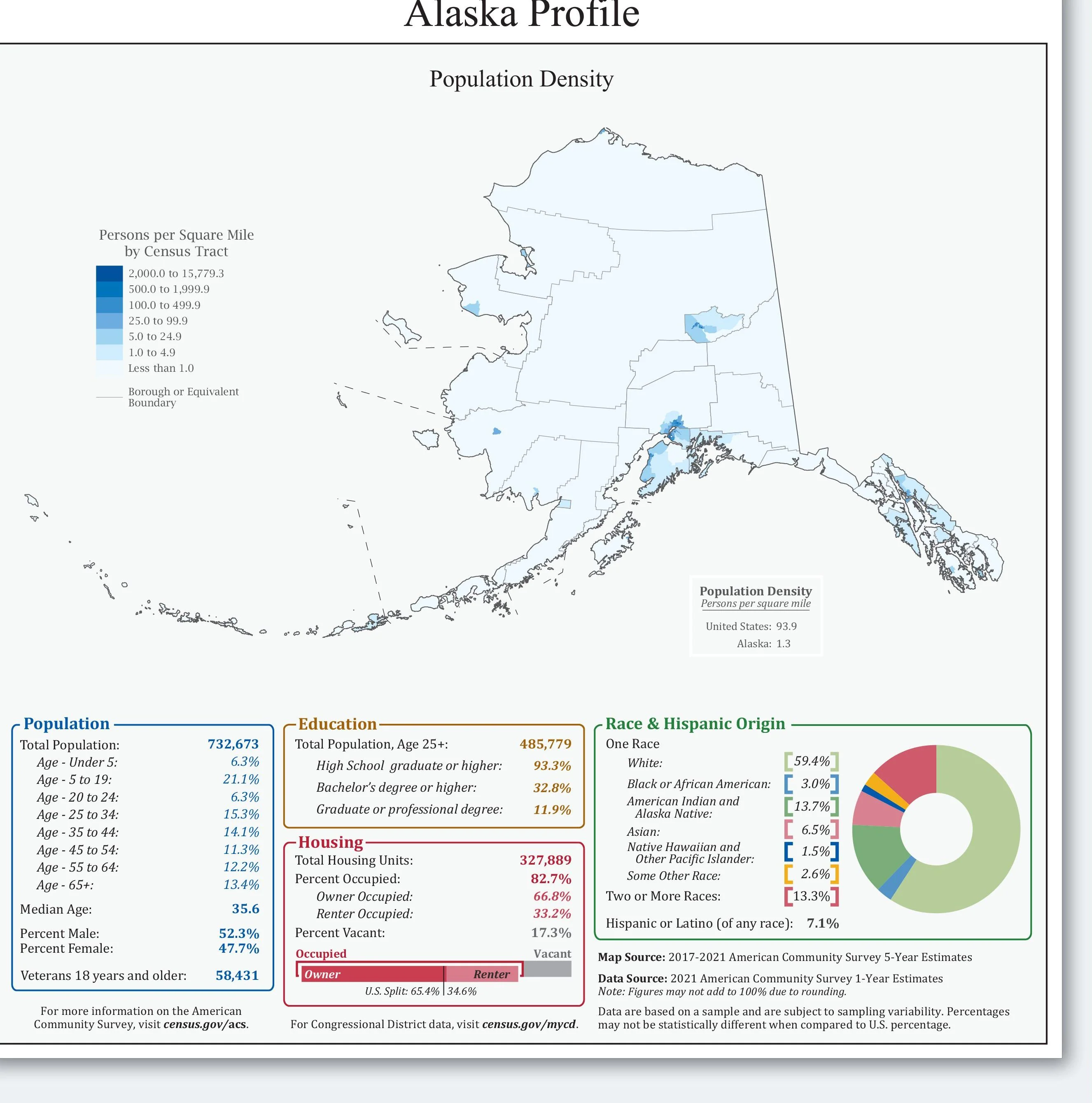
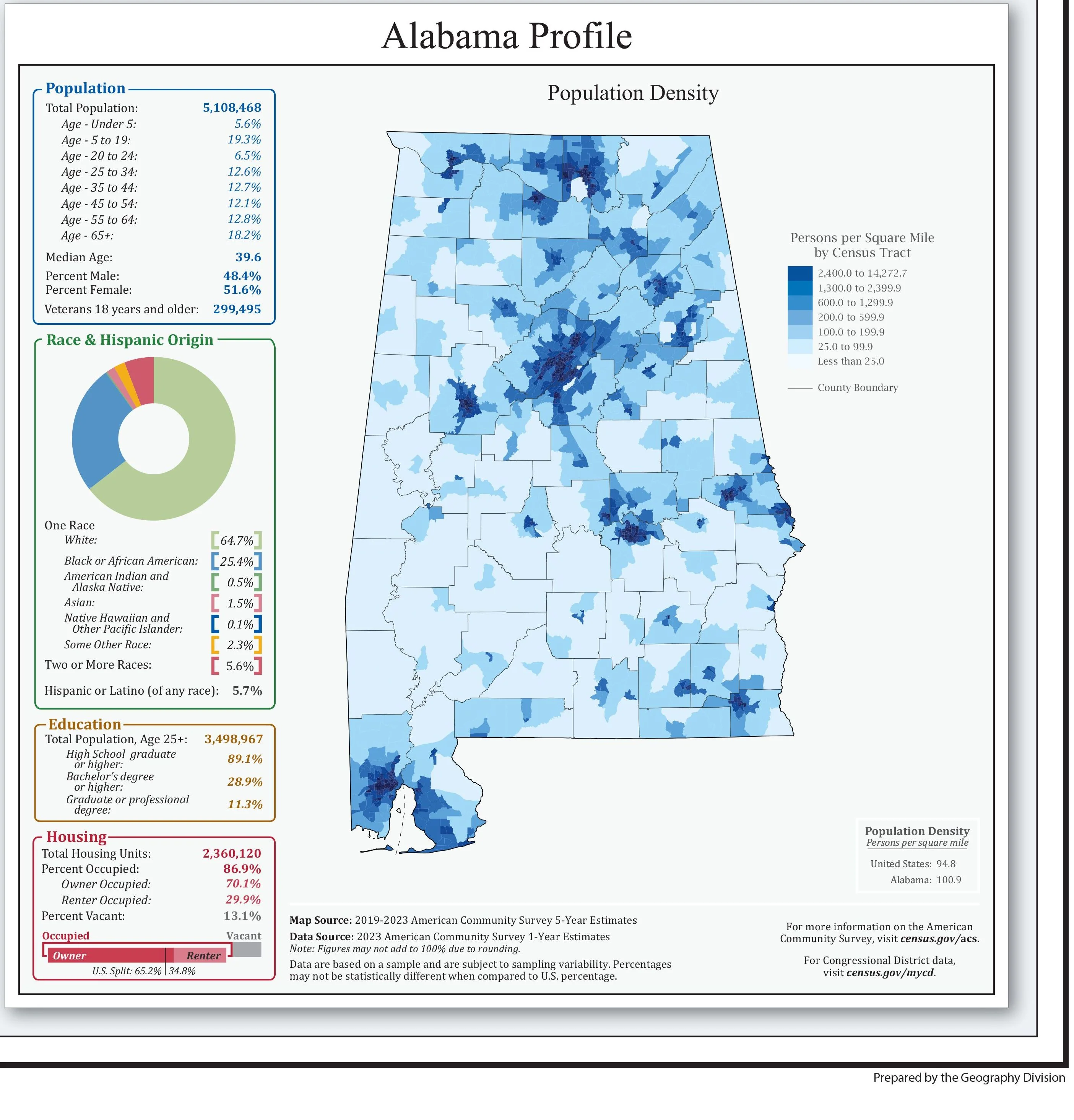
Features inset maps with population density and U.S. district totals by state
-
Based on public domain data from the U.S. Census Bureau
-
Updated for the 119th Congress (2025–2027)
-
Printed in the USA on high-quality paper
-
Ships rolled in a sturdy cardboard tube — never folded
-
Free shipping on all orders
-
Great for classrooms, campaign teams, libraries, or home offices
Whether you're an educator, public servant, or politically curious, this map offers a detailed and useful view of representation in Nevada.
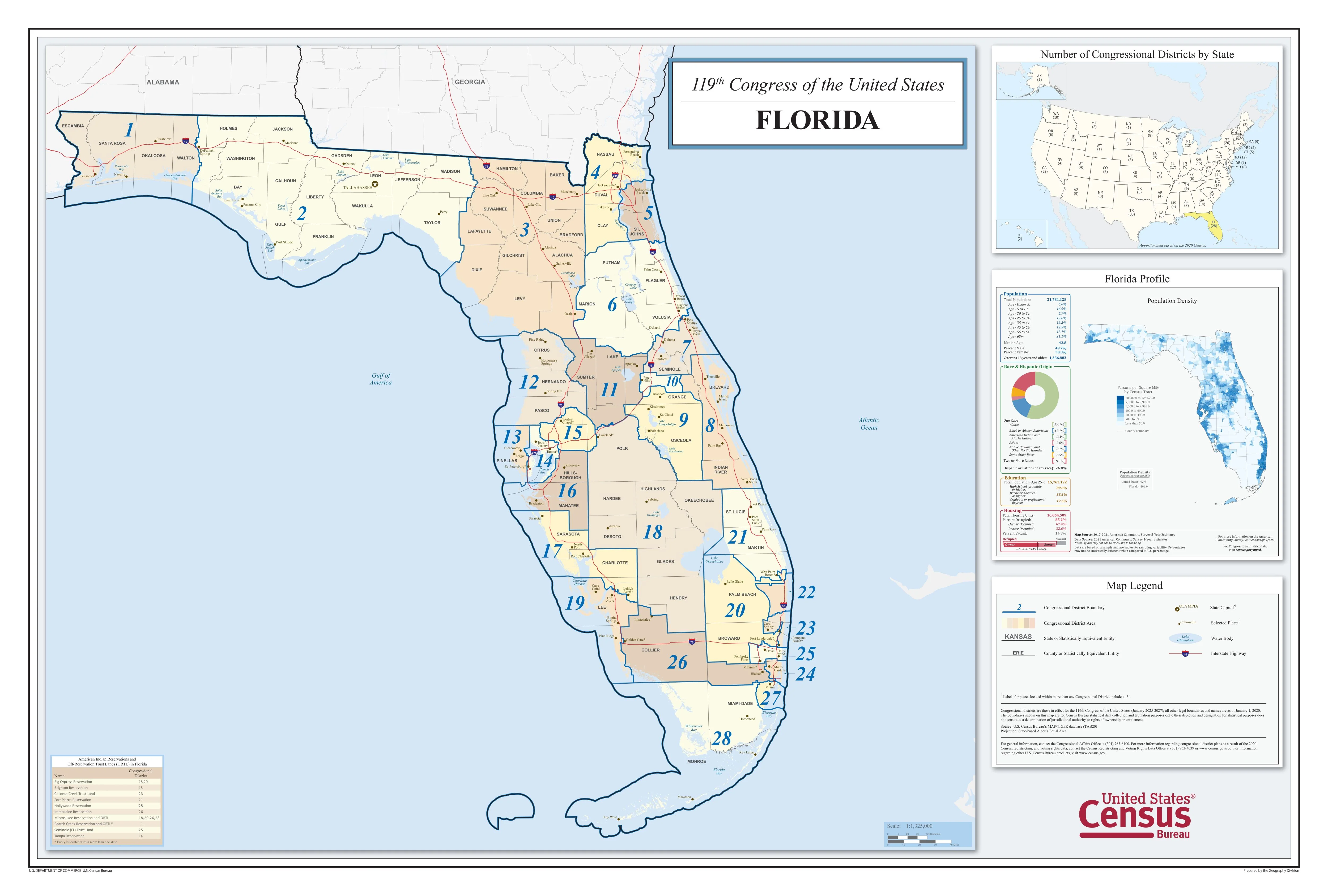
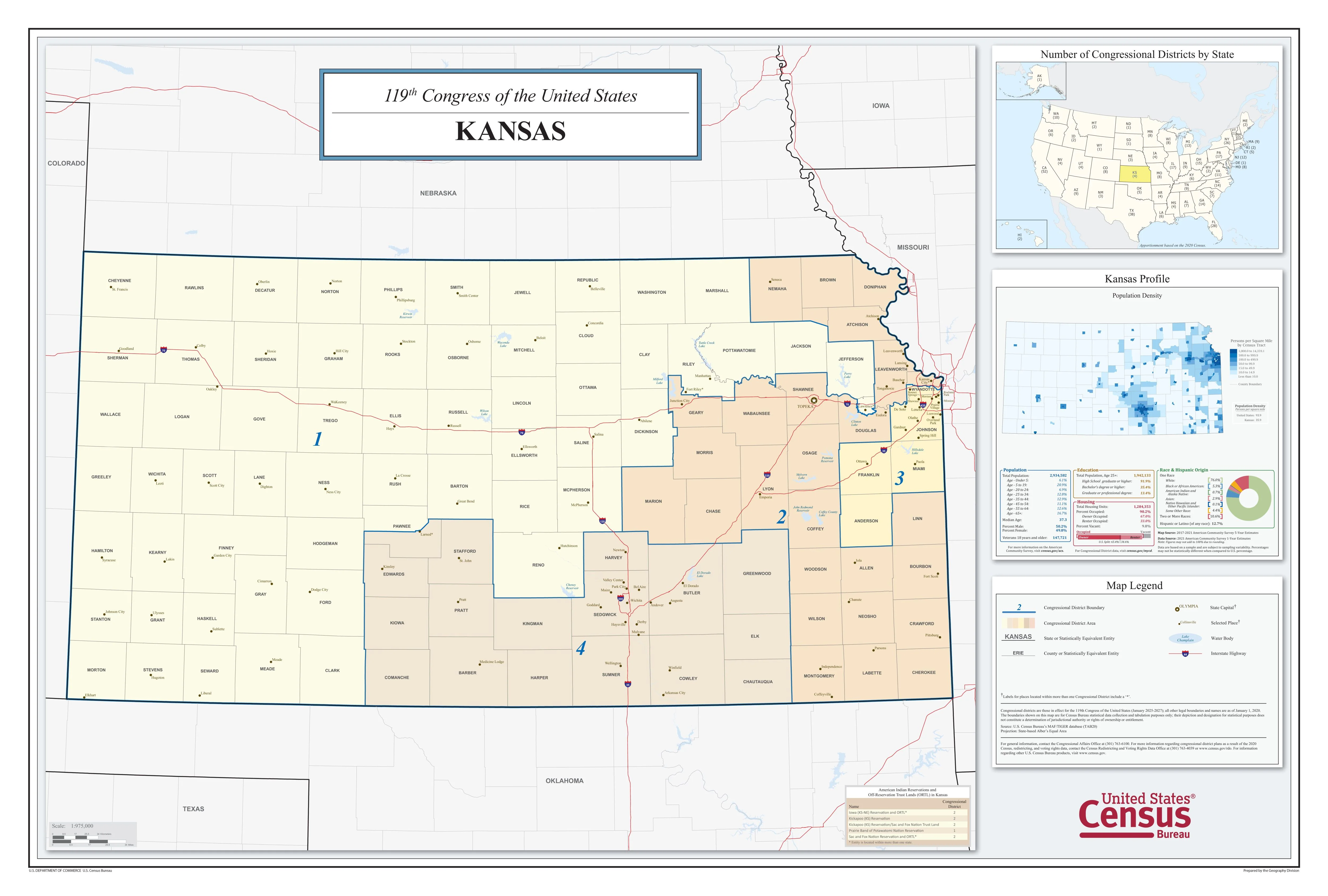
Nevada Congressional District Map
Understand Nebraska's political landscape with this updated congressional district map, designed for clarity and accuracy. Ideal for educational settings, professional offices, or anyone interested in civic engagement.
Highlights:
-
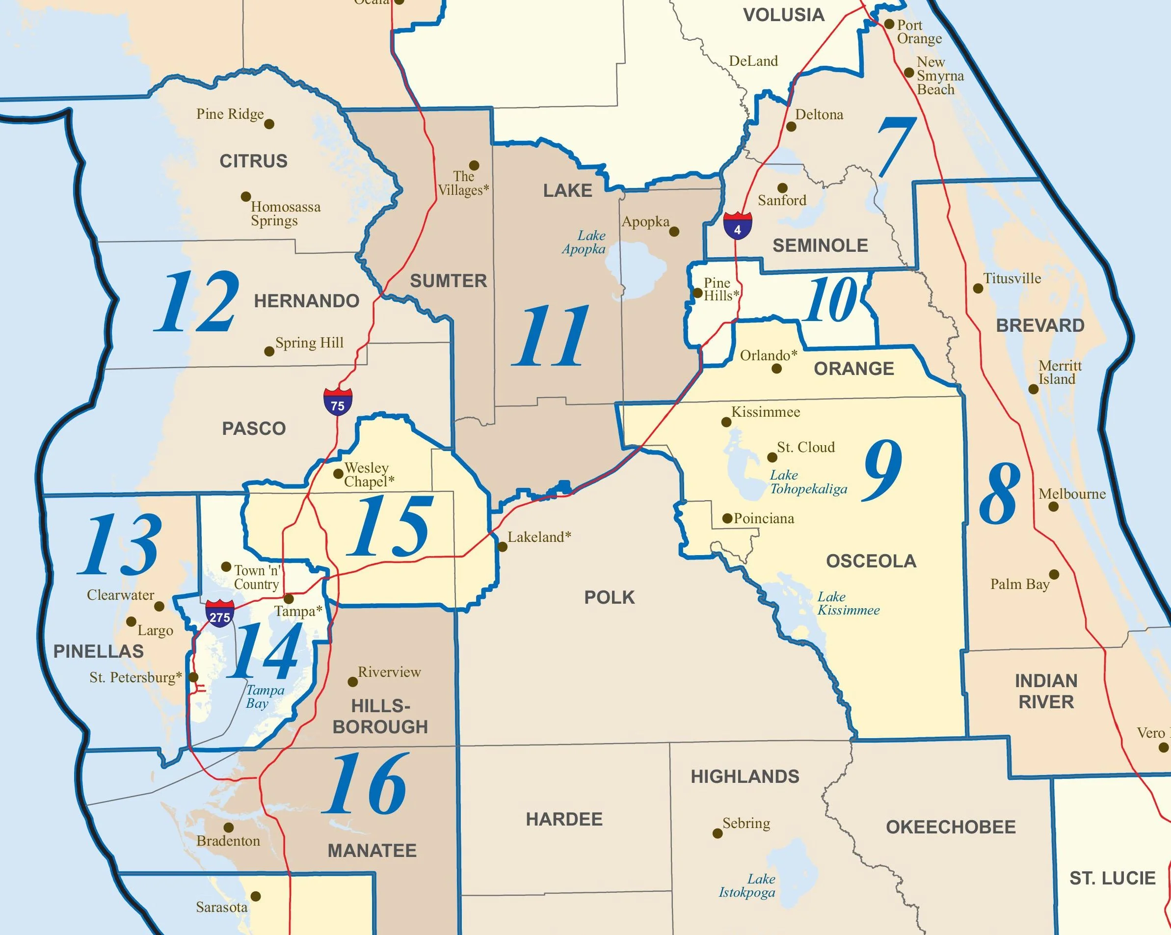
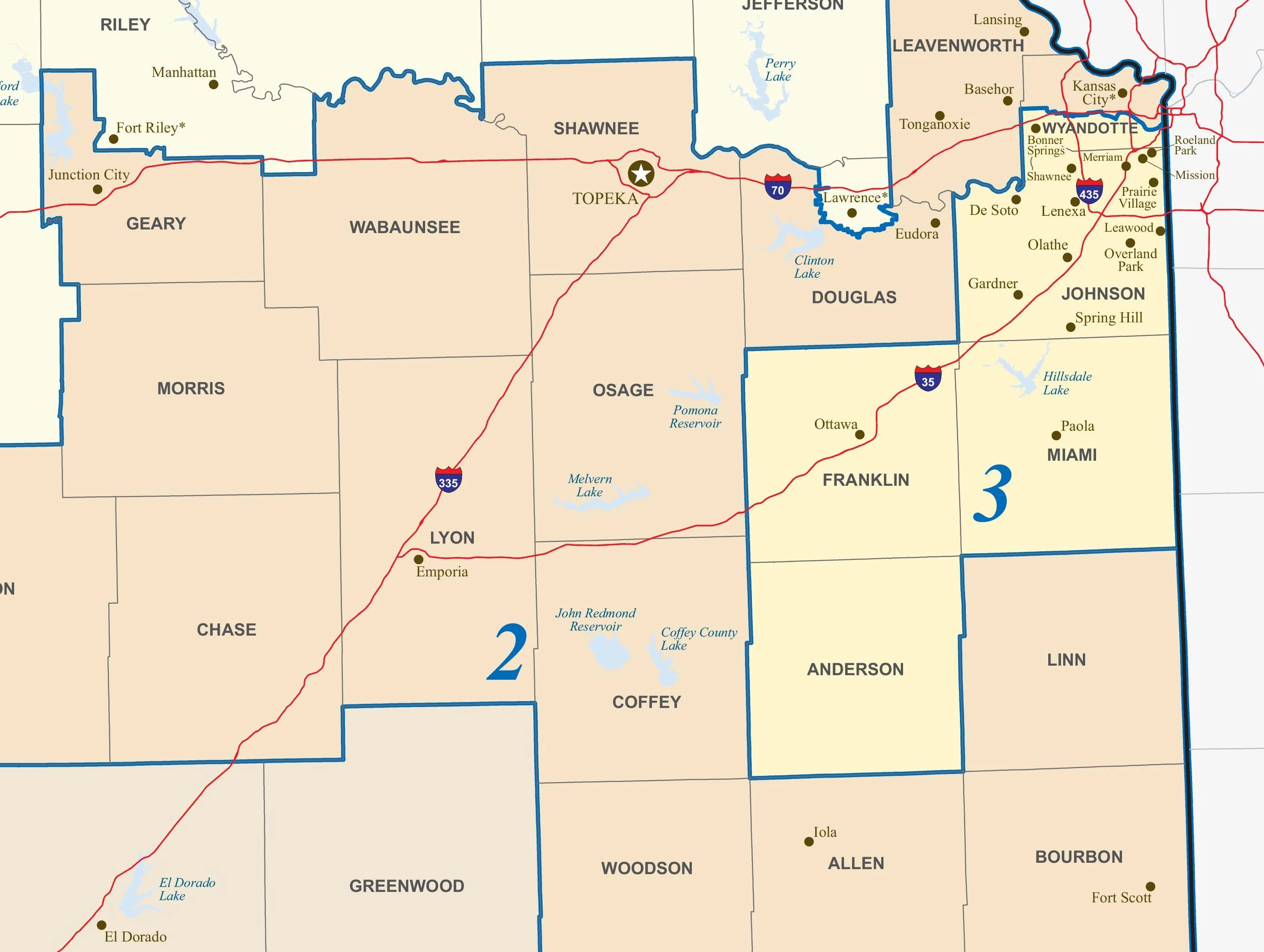
Shows all the congressional districts in Nevada with clear, color-coded boundaries
-
Includes counties, major highways, cities, and key geographic features
-
Features inset maps with population density and U.S. district totals by state
-
Based on public domain data from the U.S. Census Bureau
-
Updated for the 119th Congress (2025–2027)
-
Printed in the USA on high-quality paper
-
Ships rolled in a sturdy cardboard tube — never folded
-
Free shipping on all orders
-
Great for classrooms, campaign teams, libraries, or home offices
Whether you're an educator, public servant, or politically curious, this map offers a detailed and useful view of representation in Nevada.
Original: $59.95
-65%$59.95
$20.98Description
Nevada Congressional District Map
Understand Nebraska's political landscape with this updated congressional district map, designed for clarity and accuracy. Ideal for educational settings, professional offices, or anyone interested in civic engagement.
Highlights:
-
Shows all the congressional districts in Nevada with clear, color-coded boundaries
-
Includes counties, major highways, cities, and key geographic features
-
Features inset maps with population density and U.S. district totals by state
-
Based on public domain data from the U.S. Census Bureau
-
Updated for the 119th Congress (2025–2027)
-
Printed in the USA on high-quality paper
-
Ships rolled in a sturdy cardboard tube — never folded
-
Free shipping on all orders
-
Great for classrooms, campaign teams, libraries, or home offices
Whether you're an educator, public servant, or politically curious, this map offers a detailed and useful view of representation in Nevada.