1 / 6
+1
Corpus Christi Area Wall Map
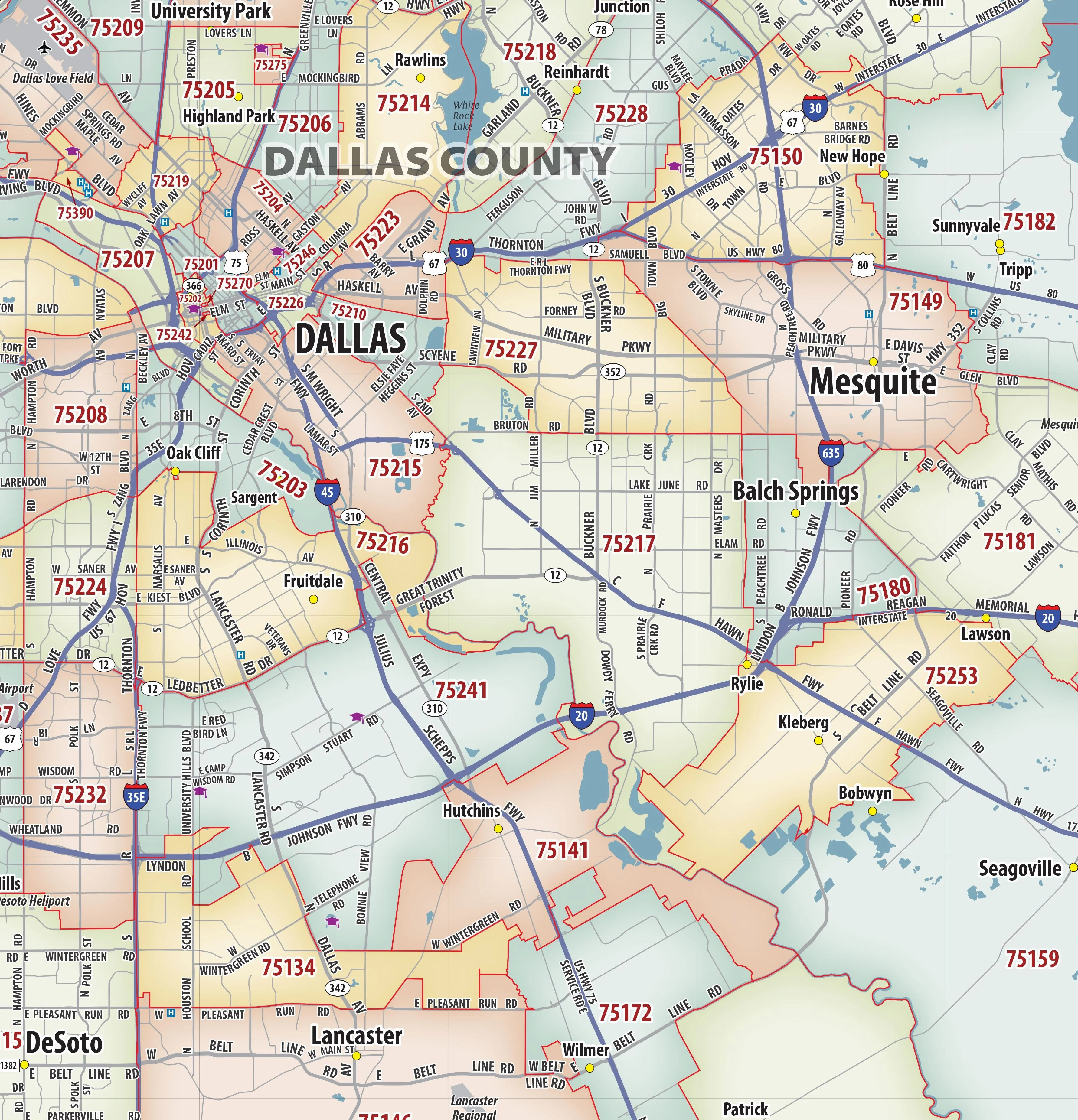
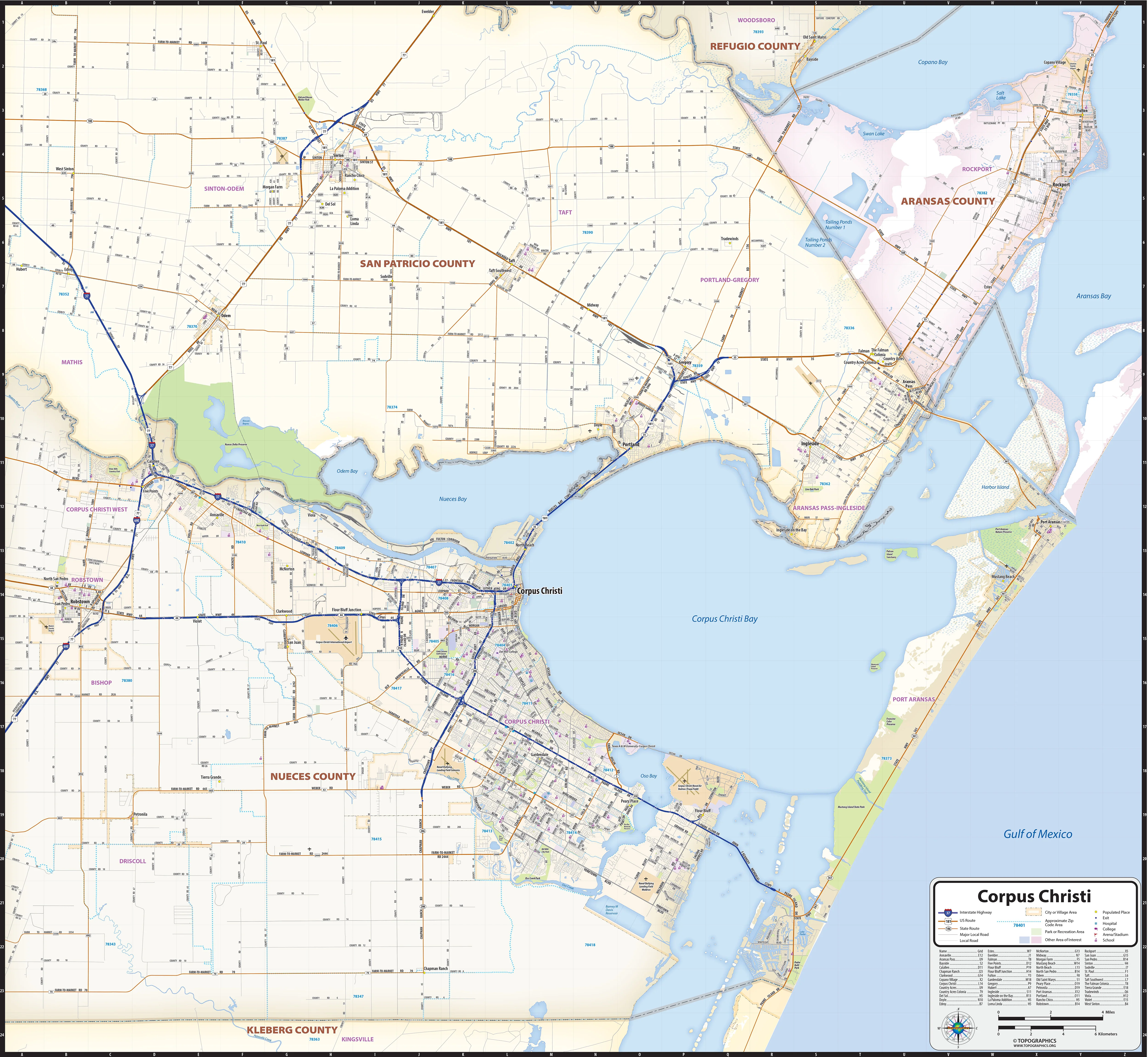
Our Corpus Christi Area wall map shows a 40 mile wide by 40 mile high area of south Texas. Besides Corpus Christi, the communities of Robstown, Odem, Sinton, Rockport, Ingleside, Portland, and Taft are shown. The map shows towns, counties, major and secondary highways and routes, as well as major points of interest. Note: due to the vast extent of this map, local street names are not shown.
This map comes in a variety of sizes and finishing options. It is shipped rolled in a sturdy cardboard tube.
Select Size
Select Material
From $27.98
Original: $79.95
-65%Corpus Christi Area Wall Map—
$79.95
$27.98Description
Our Corpus Christi Area wall map shows a 40 mile wide by 40 mile high area of south Texas. Besides Corpus Christi, the communities of Robstown, Odem, Sinton, Rockport, Ingleside, Portland, and Taft are shown. The map shows towns, counties, major and secondary highways and routes, as well as major points of interest. Note: due to the vast extent of this map, local street names are not shown.
This map comes in a variety of sizes and finishing options. It is shipped rolled in a sturdy cardboard tube.